Lac des Fétoules by le Refuge de la Lavey


Description
TECHNICAL INFORMATION
Start: Lavey refuge 1797m
Ascent: 550 m
Duration:
outward journey 4h
Distance: 10.8 km
Difficult
Difficult steep sections
MAPS AND TOPOS
IGN Top 25 map n°3336Et
Topo map OBP n°5 (Oisans au Bout des Pieds), trail 531-539
YOU'RE HIKING IN THE HEART OF THE ECRINS NATIONAL PARK
The Écrins massif is an exceptional area, open to all, with a rare natural, cultural and landscape heritage.
and landscapes. To protect these treasures, the heart of the park is marked with blue-white-red painted flags, where regulations must be respected. Please take note of them when preparing your hike
to preserve this collective asset on the ecrins-parcnational.fr website.
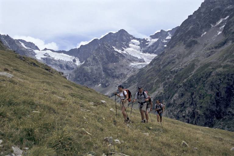
ITINERARY
After the Lavey refuge, cross the Muande torrent and turn left towards Lac des Fétoules. A steep, winding climb awaits you through grassy slopes and scree.
At 2,249 m, you arrive at the small mountain lake of Les Fétoules on a small grassy plateau, with a magical, unobstructed view over the Vénéon valley and the peaks of the Écrins massif.
Continue towards Champhorent to return to the parking lot, or take the same route back to the refuge.
In summer, you'll come across herds of cattle in alpine pastures, so avoid them wherever possible.