
Lakes of the Emparis Plateau - Hike from Singuigneret (Mizoën)


Description
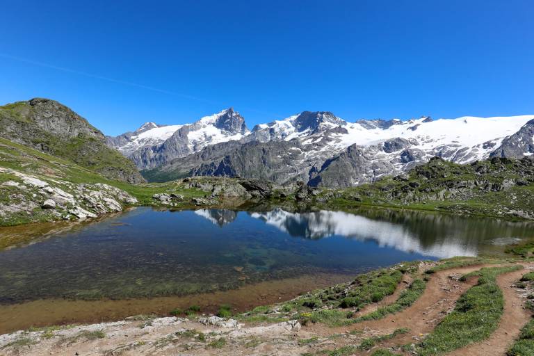
Located on the edge of the Écrins National Park, the plateau offers a magnificent view of La Meije and the surrounding glaciers. It’s obviously a paradise for hikers, lovers of the great outdoors, and anyone looking to enjoy a picnic!
A varied hike through shaded woodlands and trails winding along the mountainside. A beautiful getaway that gradually gains elevation. The route begins peacefully under the shelter of the trees before following the contours of the terrain along a more exposed trail. As you climb, the mountain landscape gradually reveals itself, culminating in a spectacular arrival on the vast Emparis plateau—an exceptional viewpoint facing La Meije. Your efforts are rewarded at the finish with a 360° panorama of the alpine meadows and the major peaks of the Écrins.
You’ll be able to admire a succession of remarkable sights along the entire route:
- The Fontaine Pétrifiante Waterfall
- The Fay and Mouterres mountain huts
- The Rif Tort Marshes
- High-altitude lakes: Lac Noir, Lac Lérié, Lac Cristallin
- Alpine pastures
- Panoramic views of La Meije and the Écrins
Marking
Yellow PDIPR sign. GR markings (red and white)
Map references
IGN TOP 25 map no. 3335 ET (Bourg d'Oisans - Alpe d'Huez)
Amenities
Guided steps
Please note: this site has been awarded the Natura 2000 label and is subject to numerous measures to preserve its biodiversity. We therefore invite you to adopt the right reflexes when you come to protect this sensitive area.
The Emparis plateau is an alpine pasture. You may come across dogs guarding the herds. For more information on how to deal with these dogs, visit pasto-kezako.fr.