Lakes of the Plateau d'Emparis - hike from Les Aymes (Mizoën)


Description
TECHNICAL INFORMATION
Start: Parking des Aymes (Mizoën). Altitude: 1,300 m.
Difference in altitude: 1377 m
Round trip time: 8 h 30
Return distance : 20.6 km
Level: Very difficult
Caution: Balcony trail on certain sections. It may present difficulties for people prone to vertigo.
MAP AND TOPO
- IGN TOP 25 map no. 3335 ET (Bourg d'Oisans - Alpe d'Huez)
- OBP map and topo n°3 (Oisans au Bout des Pieds): trails n°343 and n°416 (in part) on the outward journey, then n°359 and again n°343 on the return. On sale at Oisans Tourisme tourist offices.
ITINERARY
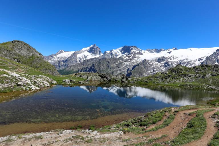
Take the path that starts at the end of the Aymes parking lot, and continue straight on to the hamlet of Les Clots, following the GR markings (red and white). The path is initially wide and shady, but after a few minutes becomes narrow, balcony-like and open. This part of the trail is not very steep. After this, you can make a detour to Lac Lovitel and its discovery trail leading to an orientation table. Shortly afterwards, you'll reach the refuge des Clots, with its panoramic view of the Meije and the Fontaine Pétrifiante waterfall. To reach the plateau, take the path towards the waterfall. From this point on, the path becomes steeper (approx. 600 m ascent over 1.6 km). Stay on the path and follow the GR markings until you reach the plateau, where the trail continues to climb, but less steeply. At the Fay and Mouterres refuges, the trail gradually descends along the Rif Tort towards the center of the Emparis plateau. Once you reach the center of the plateau, you'll have a 360-degree view of the plateau's Alpine pastures, with their air of Mongolian steppes. At the center of the plateau, take the right-hand track (GR54) towards the Col du Souchet (2365 m). At the pass, leave the GR54 (which leads down to Le Chazelet) and turn right into the grassy Combe leading to the edge of Lac Lérié. Continue right over the lake to reach Lac Noir. From here, an exceptional panorama of the Meije and Râteau peaks awaits you, with the Rousses massif to the north. From the lake, follow the path north to the center of the plateau. Follow the same route down to Les Aymes.
THINGS TO SEE ALONG THE WAY
- Petrifying Fountain waterfall
- Refuges du Fay and des Mouterres
- Rif Tort marshes
- Lac Noir, Lac Lérié, Lac Cristallin
- Alpine pastures
- Panoramic views of the Meije and Écrins mountains
NEARBY ATTRACTIONS
- Village of Mizoën