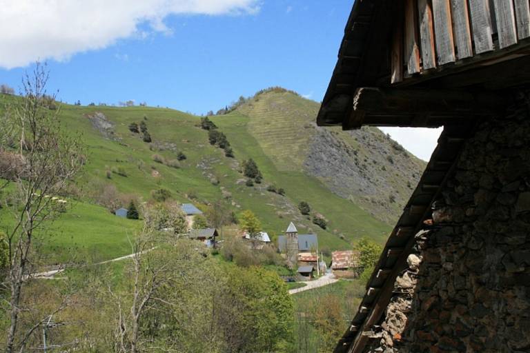
Le Puy d'Oulles
Medium
1h45min
4km
+166m
-152m

1 / 2
Description
Starting from the tiny village of Oulles, the hike is an opportunity to explore the abandoned hamlet of Le Puy d'Oulles.
TECHNICAL INFORMATION
Starting point: Le Pouillard car park in Oulles
Elevation gain: 265 m
Total duration: 1 3/4 hours
Distance: 4.7 km
Level: Easy
MAP
OBP no.1 (Oisans au Bout des Pieds): path 624
DURING THE HIKE
This is such a steep area that it is best never to leave the path. There is a local saying that the terrain is so steep in Oulles that the inhabitants used to shoe their chickens!