Les 7 Laux - hike from Rivier d'Allemond

Description
Shortly after Rivier d'Allemond, park on the old Col de la Croix de Fer road, which runs off to the left and ends in a cul de sac, in front of the huge landslide that forced its reconstruction on the opposite slope.
TECHNICAL INFORMATION:
Start: Le Rivier d'Allemond
Ascent: 904 m
Distance: 5.4 km
Level: difficult
ROUTE :
After Le Rivier, continue along the road for about 2 km to the junction of the old road (blocked) and the new road, which winds its way down to the valley floor. The trailhead is at this junction. The path crosses the valley side for around 1 km, then climbs steeply up the combe des 7 Laux.
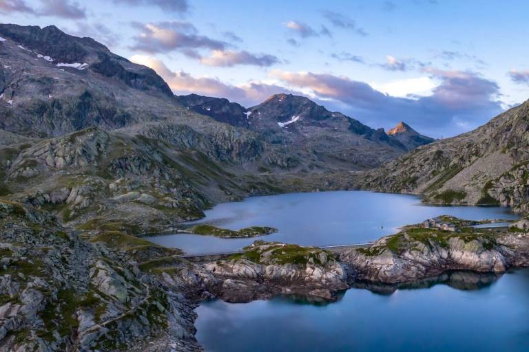
At the top of the plateau, the Lac de la Sagne comes into view. The succession of lakes leads from Oisans to Grésivaudan.
For the return journey, a variant is possible via the Col de la Vache, with a negative altitude gain of 1,200 m.
GOOD TO KNOW :
Ibex spot! This area is rich in chamois and ibex, a species reintroduced in 1983 by hunters and EDF when the Grand' Maison dam was built. The 7 Laux, as their name suggests, comprise 10 lakes: Lac de la Sagne, Lac de la Corne, Lac Jeplan, Lac Agnelin, Lac du Cos, Lac Blanc, Lac Cottepens, Lac Carré, Lac de la Motte and Lac Noir.
Following the lakes, you cross the Belledonne massif.