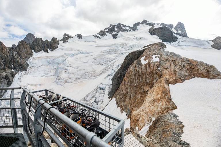
Refuge de l’Aigle at the Rocher de l’Aigle (3,450 m)
Hard
48h
12.59km
+2251m
-2250m

1 / 2
Description
Taking in every alpine zone, from the Romanche mountain river to the Tabuchet glacier, this long ascent is a wonderful discovery of the high-mountain environment. It is not only about the ambience and the landscape but also following in the footsteps of the pioneers of late nineteenth century mountaineering. Clinging to the Rocher de l'Aigle 3,450 m, initially a bivouac site, the refuge that bears its name was built in 1910 and completely rebuilt in 2014.