

Refuge du Promontoire - hike from Combe Noire/la Bérarde
Expert
7h30min
21.5km
Round trip
+1300m

1 / 5
Description
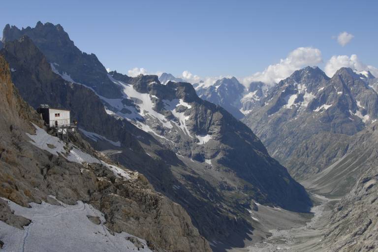
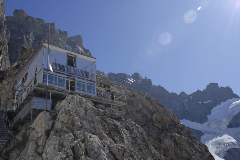
Climbing up to a high mountain refuge is an opportunity to slip into the skin of a mountaineer. Suspended above the void, the refuge lives up to its name.
TECHNICAL INFORMATION
Departure : Combe Noire / la Bérarde
Difference in altitude: 1300m
Duration: 4 h outward journey, 3 h 30 return journey
Distance: 21 km
Level :
Difficult hike
MAPS AND TOPO
OBP map n°5 (Oisans au Bout des Pieds): trails n°551 and 558
IGN Top 25 map n°3436 ET
YOU ARE HIKING IN THE HEART OF THE ECRINS NATIONAL PARK
The Écrins massif is an exceptional area, open to all, with a rare natural, cultural and landscape heritage. To protect these treasures, the heart of the park is marked with blue-white-red painted flags, where regulations must be respected. Please take note of them when planning your hike to preserve this collective asset on the ecrins-parcnational.fr website.
ITINERARY
From the shuttle bus stop, follow the road to the La Bérarde signpost, then take the path on your left towards the Chatelleret refuge. The ascent begins amidst ancient terraces once shaped and cultivated. At the Tête de la Maye fork, continue to the Génie footbridge and continue along the left bank of the Étançons torrent. On your right you can see the Bonnepierre valley and the south-west face of the Écrins, a magnificent mineral cathedral. Keep your eyes and ears open to see and hear the marmots and chamois that are very present in this pasture on the Étançons plateau.
As you round a bend, "dame Meije" and its square glacier, a veritable wall, appear before you, the south face impressive in its verticality and austerity. Conquered by Pierre Gaspard and Boileau de Castelnau on August 16, 1877. Once you've reached the Chatelleret refuge, which was closed following a torrential lava flow in 2022, you can see the Promontoire refuge higher up, clinging to the south face of the Meije.
Once you've reached Le Châtelleret, leave the Col du Replat path on your left and head for the large moraine that separates the valley, where you may still have to cross some névés. Follow the path along the long ridge to the impressive rocky promontory below the refuge.
- Or climb the ridge below the refuge, using the cables installed to facilitate progress over 150m. A harness, helmet and via-ferrata lanyard are recommended (blue markings).
- Either head horizontally left to avoid the glacier's alluvial cone and rocky bar, then climb right towards the bottom of the glacier. You then cross rocky slabs, horizontally under the glacier, before reaching the refuge via a névé (in early season) or via the rocks (red markers and cairns).
In both cases, it's no longer just a walk on the trail, but a first step into the high mountains, towards a prestigious refuge giving access to races that are no less prestigious.
NEARBY
Mountaineering and climbing :
- La traversée de la Meije (3982m): the race par excellence from Le Promontoire, recalling the historic feat of Pierre Gaspard and Emmanuel Boileau de Castelneau in 1877. The itinerary itself is subtle and complicated, lending its credentials to this aesthetically pleasing, varied and committed race, a great Alpine classic that is still very
classic. - Numerous routes have been opened on the south face, from Pierre Allain's direct route to modern routes on very good rock.
- The south-west face also offers some great classics: "la voie des marseillais", "Nous partirons dans l'ivresse"...
- The west ridge of the Pointe des Aigles (3338m), a fallback option in case of uncertain weather.
- The east face and northeast ridge of Le Râteau (3809m), early-season mixed climbs.
- The Brèche de la Meije (3357m) for an introduction to mountaineering, with the option of crossing to the Aigle hut via the Serret du Savon.
NOTES
In spring, the refuge is the stop-off point for several must-do mountain ski tours: the Tour de la Meije, via the Brèche and the Serret du Savon, which leads to the magical descents of the Glacier de l'Homme or the Tabuchet, and the Enfetchores, with the descent to La Grave. The final quality route is the Col du Pavé, followed by the descent to Haute-Romanche.
Marking
Map references
Amenities
Guided steps
At arrival