The Malaine track

Description
Route in the “MTB in Oisans” guide (Oisans Tourisme)
Departure: Oulles 1400 m
Arrival: La Paute 720 m
Time: 25 min.
Distance: 6 km
Highest point: 1417 m
Lowest point: 720 m
Total ascent: 30 m
Total descent: -700 m
Technique: 3/4
Endurance: 2/4
Map: Top 25 Grenoble 3335 OT
ROUTE
From Oulles, follow signs for ‘La Malaine, plaine du Bourg’ and ride to Le Piret (1401 m) next to an electricity pylon.
You’re now all set for the La Malaine descent!
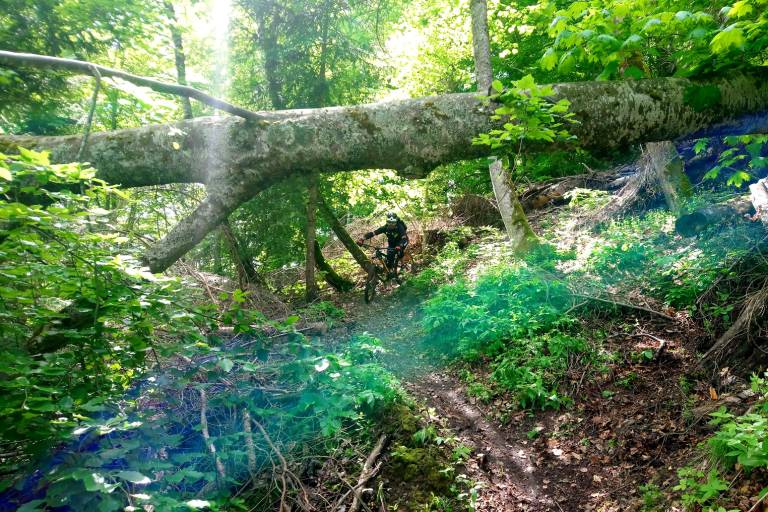
You immediately plunge into a thick forest of beech trees (remember to take clear glasses for the dark woods) on a narrow, fast path, running alongside the mountain. Take care on the traverses as it’s easy to gather speed and you never know what is hidden under the leaves (stones, roots, branches, etc.).
The descent then begins, with a rapid succession of switchbacks... so long as you have the skills, it will all be alright!
The route finishes on a fast, straight section that comes out onto a track. Turn right for an easy ride back to the hamlet of La Paute.