Le Tour des Hameaux - hiking from Saint-Christophe-en-Oisans


Description
TECHNICAL INFORMATION
Start: Saint Christophe en Oisans
Ascent: 500 m
Duration: 5 h loop
Distance: 7.8 km loop
Level :
Medium
MAP AND TOPO
IGN Top 25 map n°3336 ET
Topo map OBP n°5 (Oisans au Bout des Pieds), trails 528-529-526-561-526
ITINERARY
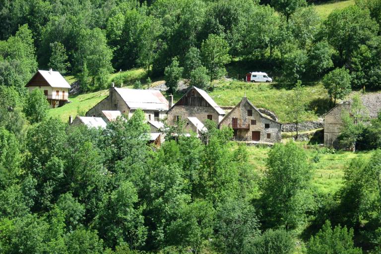
From the Saint-Christophe-en-Oisans tourist office, walk 50m and take the path on your right towards Alpe du Pin. The path descends through the forest to Les Granges. Once in the hamlet, turn left towards Bernardière. Look up, Lauranoure and the Pisse Froide waterfall are within sight. From Bernardière, a pretty, well-kept hamlet inhabited year-round, take a well-trodden path to Pré Clot, which climbs gently and steadily through the forest. Cross the RD 530 and take the road behind the gite <Les Arias> towards Champébran. The climb continues in the shade of the trees, punctuated by superb little watermills built along the way. At Champébran, you're in the middle of the trail, so take the Clot du Sert sign to climb to the top of the hamlet. Take a break here, with a breathtaking view of the Muande valley with L'Olan in the background, and of Les Fétoules and its glacier. Retrace your steps through the hamlet and head for Champhorent. Cross the RD 530 and follow the road to the refuge de la Lavey parking lot. At the 2nd hairpin turn right towards Le Clot. The shade and humidity of this coniferous forest will be beneficial during this long descent. At Le Clot, take the steeply ascending path on your right. Once on the RD 530, turn right and walk 100m back to the path, or turn left to follow the road back to Pré Clot. Then take the path towards Saint-Christophe through the pastures, where, depending on the season, you may come across herds of cattle.
THINGS TO SEE ALONG THE WAY
- The church and cemetery where some of the greatest names in mountaineering are buried.
- The "Mémoires d'Alpinismes" museum
- Pisse Froide waterfall
- Les Fétoules and Lauranoure
- The hamlets