
Tour du Signal de l'Homme - Hiking from Auris-en-Oisans

Medium
3h30min
9.5km
Loop
+315m
-315m
Tour du Signal de l'Homme - Hiking from Auris-en-Oisans image1Tour du Signal de l'Homme - Hiking from Auris-en-Oisans image2Tour du Signal de l'Homme - Hiking from Auris-en-Oisans image3
1 / 3

Description

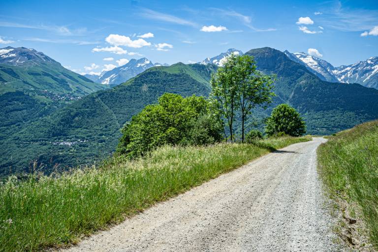
During this hike, you'll enjoy magnificent panoramic views of the Alpe d'Huez resort as well as the Écrins, Grandes Rousses, Belledonne, and Taillefer mountain ranges.

MAP AND HIKING GUIDE
OBP Map/Hiking Guide No. 3 (available at the tourist office): trails 312, 253, and 301.
IGN Top 25 Bourg d'Oisans and l'Alpe d'Huez 3335 ET.

ITINERARY
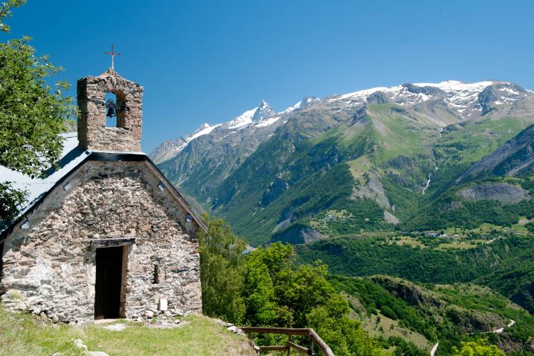
You’ll begin your hike on an easy trail along the mountainside, where the trees frame a superb view of the Écrins Massif. On one side, the flowers of the alpine meadows; on the other, the Romanche Valley... Follow the trail to the charming Saint-Giraud Chapel.
Then you’ll come to a trail that climbs gently to the hamlet of Cluy, with its chapel and a few buildings housing the sheepfolds of Auris-en-Oisans. Once past the hamlet, you’ll be back on a trail that leads to the Col de Cluy, where a panoramic view of the Pic Blanc and the Alpe d’Huez resort awaits you.
From there, you’ll descend along a vehicle-accessible trail that skirts the Signal de l’Homme to the north, all the way to the Col de Maronne. Along this trail, you’ll enjoy sweeping views of Alpe d’Huez and the Belledonne and Grandes Rousses mountain ranges.
All that’s left is to make a leisurely descent to the resort of Auris-en-Oisans, facing the Écrins massif.

This hike is ideal for a full day or a half-day, depending on your pace.

SIGHTS ALONG THE ROUTE

  • Saint-Giraud Chapel
  • The hamlet of Cluy, home to the sheepfolds of Auris-en-Oisans and the Sainte-Ilpice Chapel.

NEARBY ATTRACTIONS

  • The mountain pastures with the two shepherds, 2,700 sheep, and the guard dogs.

Marking

Yellow PDIPR signs.

Map references

IGN Top 25 Bourg d'Oisans and Alpe d'Huez 3335 ET

Amenities

Guided steps

Behind the Odalys residence, start the trail at the signpost marked “Col de Cluy.”
At the fork, continue straight ahead, following the directions on the sign.
Pass the pretty Saint-Giraud Chapel on your right, and continue until you reach a dirt road. Turn left onto it; the Col de Cluy is still marked on the directional signpost.
Follow the track until you reach the small hamlet of Cluy, consisting of a few stone buildings.
A little further on, on the left, leave the vehicle track and take a trail that climbs fairly steeply toward the pass (which is 800 m away). The trail climbs above the track, and a marker confirms you’re heading in the right direction. The trail then rejoins the track; follow it to the left: the pass is now only 100 m away.
At the pass, follow the track on the left toward the Col de Maronne.
A marker indicates that you should continue to the left on the well-marked trail rather than continue down the track toward Combe Lombard.
A new sign indicates that the Col de Maronne is 1.6 kilometers away; you’ll reach it via an easy trail. Once at the Col de Maronne, take the vehicle-accessible trail on your left, which will lead you to the resort, passing by the barbecue area and its zip line.

Address
16 Place des Orgières, 38142, Auris-en-Oisans
Opening
From 15/05 to 31/10 daily. The periods during which the trails are accessible vary from year to year depending on snow cover and weather conditions. In addition, trail conditions can change rapidly after a weather event and are not checked daily. If you encounter a section of the trail that is in poor condition or dangerous, turn back and report it to the tourist office.

Was this content helpful to you?

Address
16 Place des Orgières, 38142, Auris-en-Oisans
Opening
From 15/05 to 31/10 daily. The periods during which the trails are accessible vary from year to year depending on snow cover and weather conditions. In addition, trail conditions can change rapidly after a weather event and are not checked daily. If you encounter a section of the trail that is in poor condition or dangerous, turn back and report it to the tourist office.