La Croix du Carrelet - Hiking from Villard-Reymond


Description
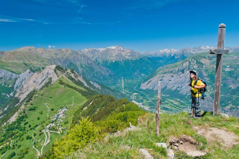
This easy, high-level hike offers a complete portrait of the Oisans region: forest, alpine pastures, crests and breathtaking views!
One panorama follows another: of the Grand Renaud from Villard-Reymond, of the Romanche valley and the Grandes Rousses massif from the Col du Solude, and of the Ecrins massif and the lower Vénéon valley from the Croix du Carrelet. Magnificent, we tell you!
TECHNICAL INFORMATION
Departure point: VIllard-Reymond
Ascent: 470 m
Round trip time: 3h00
Round trip distance: 6 km
Level: Medium
MAP AND TOPO
TOP 25 IGN 3335 ET - Bourg d'Oisans, Alpe d'Huez
Topo map OBP n°1 (Oisans au bout des Pieds), trail 620
ITINERARY :
Park at the entrance to Villard-Reymond and start by strolling through the village, amidst the old farmhouses, renovated or still in their original state. Follow the track out of the village to the Col du Solude. You're now at the top of the Prégentil cliff overlooking Bourg-d'Oisans... The path begins on the right and climbs through the forest to the "Maisons du Loup", a shady spot at the intersection of the two paths. Continue on the opposite path. At the next intersection, continue on the same path towards Croix du Carrelet,
then follow the left-hand path, which winds up a short, winding climb to the cross.
Good to know: you can make a loop back down to Villard-Notre-Dame, which you can of course visit, and then return to Villard-Reymond via the forest track that joins the Col du Solude.